جزئیات کتاب
فرمت
جلد سخت
صفحات
304
زبان
انگلیسی
منتشر شده
Sep 1, 2014
ناشر
HarperCollins UK
ISBN-10
0007522207
ISBN-13
9780007522200
توضیحات
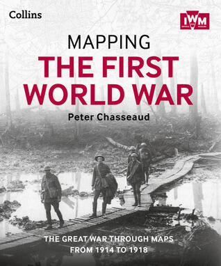
This engaging work invites readers to explore the tumultuous years of World War I through the lens of historical maps. It artfully compiles a diverse collection that illustrates the geographical and strategic developments of the war from 1914 to 1918. Each map serves as a portal into the past, enabling an understanding of the shifting frontiers and the psychological realities faced by those entrenched in conflict.
The authors, including Peter Chasseaud and experts from the Imperial War Museum, delve into the intricacies of military strategy and geography, showing how terrain influenced battles and decisions. By presenting detailed overlays and annotations, the book provides a comprehensive visual narrative that enhances the reader's grasp of the war's complexities.
As the narrative unfolds, it unearths not only the military aspects but also the human experiences behind the geographical changes. Through vivid visuals and insightful commentary, this work captures the harrowing essence of the Great War, granting readers a deeper appreciation of its historical significance.
The authors, including Peter Chasseaud and experts from the Imperial War Museum, delve into the intricacies of military strategy and geography, showing how terrain influenced battles and decisions. By presenting detailed overlays and annotations, the book provides a comprehensive visual narrative that enhances the reader's grasp of the war's complexities.
As the narrative unfolds, it unearths not only the military aspects but also the human experiences behind the geographical changes. Through vivid visuals and insightful commentary, this work captures the harrowing essence of the Great War, granting readers a deeper appreciation of its historical significance.
ژانرها
اکشن و ماجراجویی
تاریخ